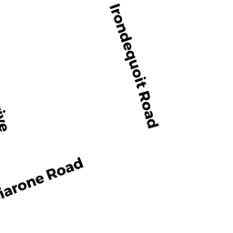
175 IRONDEQUOIT RD
Owner Information
BARRY KEVIN M
175 IRONDEQUOIT ROAD
FRANKLIN, MA 02038


Property Details
175 IRONDEQUOIT RD is classified as a Single Family Residential (Contemporary).
The primary structure on this property was built in 2001. There are 3,410ft2 of built area within this property. There is 3,410ft2 of residential/living space within this property. This property is listed as having 9 rooms.
175 IRONDEQUOIT RD is valued at $660,000. The land is valued at $259,900 and the structures are valued at $400,100.
The most recent deed for 175 IRONDEQUOIT RD is recorded at the local registrar in Book 38194, Page 514. 175 IRONDEQUOIT RD was last sold on Monday, August 10, 2020 for $680,000.
Assessment data from fiscal year 2022.
Flood Data
According to the FEMA National Flood Hazard Layer, this property does not appear to be in a flood zone. It may also be in an area not yet reviewed. Nonetheless, confirm this information prior to taking any action.
To view the flood hazards around this property, create a FEMA "Firmette" Map of the area around 175 IRONDEQUOIT RD.
Broadband Internet Providers
| Provider | Type | Bandwidth (mbps) | |
|---|---|---|---|
| Viasat Inc | Satellite | 100 | 3 |
| Verizon New England Inc. | DSL | 10 | 1 |
| VSAT Systems, LLC. | Satellite | 2 | 1 |
| HughesNet | Satellite | 25 | 3 |
| GCI Communication Corp. | Satellite | 0 | 0 |
| T-Mobile | Fixed Wireless | 25 | 3 |
| Comcast | Cable | 1000 | 35 |
| Verizon New England Inc. | Fiber | 940 | 880 |
Broadband service provider data from December 2020.
Adjacent Properties
- 5 LUCIUS ST
Single Family Residential owned by ROSSETTI JAMES W - 213 IRONDEQUOIT RD
Single Family Residential owned by POIRIER CHARLES & STEPHANIE TRS - 402 OAK ST
Single Family Residential owned by SAPAROFF NICHOLAS W & DEBORAH TRS - 219 IRONDEQUOIT RD
Single Family Residential owned by TRAPP JAMES K - 207 IRONDEQUOIT RD
Single Family Residential owned by FRADKIN MICHAEL S & DEBRA L TRS - 7 LUCIUS ST
Single Family Residential owned by COSCO CATHI A - 201 IRONDEQUOIT RD
Single Family Residential owned by HALLORAN KATHLEEN - 191 IRONDEQUOIT RD
Single Family Residential owned by BERNSTEIN JOEL M - 181 IRONDEQUOIT RD
Single Family Residential owned by LAWRENCE JAMES M - 10 LUCIUS ST
Single Family Residential owned by SWEDBERG PAUL R - 0 VETERANS MEMORIAL DR
Vacant, Selectmen or City Council (Municipal) owned by FRANKLIN MUNICIPAL AFFORDABLE